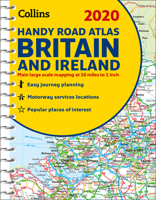
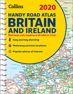
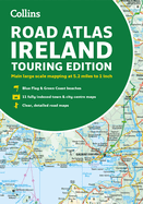
This easy-to-use, handy A5 sized road atlas with popular lie-flat spiral binding features extremely clear route planning maps of Britain and Ireland and fits neatly into your glove box, briefcase or bag. The atlas has been fully updated for 2020. The maps of Britain are at 9.9 miles to 1 inch (1:625,000) and the whole of Ireland is covered at 15.8 miles to 1 inch (1:1,000,000). There are also a selection of more detailed urban area maps at 4.5 miles to 1 inch (1:285,000) to aid route planning in these busy areas. ...
Read More
This easy-to-use, handy A5 sized road atlas with popular lie-flat spiral binding features extremely clear route planning maps of Britain and Ireland and fits neatly into your glove box, briefcase or bag. The atlas has been fully updated for 2020. The maps of Britain are at 9.9 miles to 1 inch (1:625,000) and the whole of Ireland is covered at 15.8 miles to 1 inch (1:1,000,000). There are also a selection of more detailed urban area maps at 4.5 miles to 1 inch (1:285,000) to aid route planning in these busy areas. * Road maps that focus on the main roads, motorways and settlements * More detailed maps of London, Manchester, Merseyside and West Midlands * Park & Ride locations (for bus and rail) * Handy distance calculator chart highlighting distances between the major towns
Read Less
Add this copy of 2020 Collins Handy Road Atlas Britain and Ireland to cart. $8.09, very good condition, Sold by BookDrop rated 3.0 out of 5 stars, ships from Phoenix, AZ, UNITED STATES, published 2019 by Collins.
Choose your shipping method in Checkout. Costs may vary based on destination.
Seller's Description:
Very good. Gently read. May have name of previous ownership or ex-library edition. Binding tight; spine straight and smooth with no creasing; covers clean and crisp. Minimal signs of handling or shelving. 100% GUARANTEE! Shipped with delivery confirmation if you're not satisfied with purchase please return item for full refund. Ships USPS Media Mail.
Add this copy of 2020 Collins Handy Road Atlas Britain and Ireland to cart. $8.97, very good condition, Sold by 8trax Media rated 5.0 out of 5 stars, ships from Mansfield, MA, UNITED STATES, published 2019 by Collins.
Add this copy of 2020 Collins Handy Road Atlas Britain and Ireland to cart. $12.95, new condition, Sold by Wide World Maps & More rated 4.0 out of 5 stars, ships from Phoenix, AZ, UNITED STATES, published 2019 by Collins.
Add this copy of 2020 Collins Handy Road Atlas Britain and Ireland to cart. $22.03, new condition, Sold by Kennys.ie rated 4.0 out of 5 stars, ships from Galway, IRELAND, published 2019 by Collins.
Add this copy of 2020 Collins Handy Road Atlas Britain and Ireland to cart. $25.67, good condition, Sold by Bonita rated 4.0 out of 5 stars, ships from Santa Clarita, CA, UNITED STATES, published 2019 by Collins.
Add this copy of 2020 Collins Handy Road Atlas Britain and Ireland to cart. $38.97, new condition, Sold by BetterBookDeals rated 3.0 out of 5 stars, ships from Toronto, ON, CANADA, published 2019 by Collins.
Add this copy of 2020 Collins Handy Road Atlas Britain and Ireland to cart. $47.33, new condition, Sold by Bonita rated 4.0 out of 5 stars, ships from Santa Clarita, CA, UNITED STATES, published 2019 by Collins.
Add this copy of 2020 Collins Handy Road Atlas Britain and Ireland to cart. $52.10, new condition, Sold by Just one more Chapter rated 3.0 out of 5 stars, ships from Miramar, FL, UNITED STATES, published 2019 by Collins.