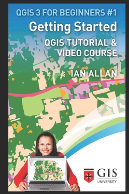
I've been a GIS and thematic mapping researcher, teacher and consultant since 1993. Join me in this step-by-step follow-along style practical QGIS tutorial. I'll have you exploring maps, thematic mapping and solving geographical problems in no time. In part 1 , you'll download and install QGIS 3, and the practice dataset. Then you'll learn basic QGIS skills like opening maps, tables and air photos, and zooming, panning and interactive querying. In part 2 , you'll learn how to harness the relationship between maps and ...
Read More
I've been a GIS and thematic mapping researcher, teacher and consultant since 1993. Join me in this step-by-step follow-along style practical QGIS tutorial. I'll have you exploring maps, thematic mapping and solving geographical problems in no time. In part 1 , you'll download and install QGIS 3, and the practice dataset. Then you'll learn basic QGIS skills like opening maps, tables and air photos, and zooming, panning and interactive querying. In part 2 , you'll learn how to harness the relationship between maps and tables to simplify complex geographical problems. You'll gain insights into thematic mapping - selecting color schemes and the need to validate your maps. And you'll put your new skills into practice with two thematic mapping projects: shading a data category map and creating time series maps. In this QGIS tutorial, you will learn... How to download and install QGIS 3. How to open, navigate and interpret GIS maps and air photos. Change how they look on screen. Thematic mapping: Generalize Geospatial data. How to find a colour scheme when you're thematic mapping. QGIS is map making software! The basics of GeoSpatial analysis. To understand the relationship between GIS maps and the tables that lie behind them. How to validate geospatial data. GIS concepts: Recognizing limitations in GIS maps. GIS maps as rich databases. Map overlay. The four GIS map objects. Time-series Thematic mapping. Using clues from the shapes and colours in GIS maps and GIS air photos as surrogates for both socio-economic and environmental information. What is a geographic information system If you've been thinking about learning QGIS, this QGIS tutorial will have you viewing, shading and analysing GIS maps fast. * Be sure to follow the instructions inside to claim your free 4.5 hour video course! Join my 5,000+ online students
Read Less
Add this copy of Getting Started: Qgis Tutorial & Video Course to cart. $24.13, new condition, Sold by Ingram Customer Returns Center rated 5.0 out of 5 stars, ships from NV, USA, published 2019 by Independently Published.
Add this copy of Getting Started: Qgis Tutorial & Video Course (Qgis 3 to cart. $28.42, new condition, Sold by Just one more Chapter rated 3.0 out of 5 stars, ships from Miramar, FL, UNITED STATES, published 2019 by Independently published.
Add this copy of Getting Started: Qgis Tutorial & Video Course to cart. $31.55, new condition, Sold by Paperbackshop rated 4.0 out of 5 stars, ships from Bensenville, IL, UNITED STATES, published 2019 by Independently Published.
Add this copy of Getting Started: Qgis Tutorial & Video Course to cart. $44.48, new condition, Sold by Booksplease rated 4.0 out of 5 stars, ships from Southport, MERSEYSIDE, UNITED KINGDOM, published 2019 by Independently Published.
Add this copy of Getting Started: Qgis Tutorial & Video Course (Qgis 3 to cart. $53.65, good condition, Sold by Bonita rated 4.0 out of 5 stars, ships from Santa Clarita, CA, UNITED STATES, published 2019 by Independently published.
Add this copy of Getting Started: Qgis Tutorial & Video Course (Qgis 3 to cart. $80.88, new condition, Sold by Bonita rated 4.0 out of 5 stars, ships from Santa Clarita, CA, UNITED STATES, published 2019 by Independently published.