Look back to when the Americas were still the "New World", and mapmaking was still a fine art. Now available and in print at less than half its previous price, this oversized, painstakingly compiled classic collection of early printed maps from 1472 to 1700 portrays a revolution in progress. As explorers arrived in lands formerly unknown to Europe, and returned home with accounts of their travels, cartography changed to reflect new ideas. Over 600 examples in both color and black and white, range from the simple to the ...
Read More
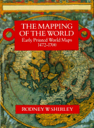
Look back to when the Americas were still the "New World", and mapmaking was still a fine art. Now available and in print at less than half its previous price, this oversized, painstakingly compiled classic collection of early printed maps from 1472 to 1700 portrays a revolution in progress. As explorers arrived in lands formerly unknown to Europe, and returned home with accounts of their travels, cartography changed to reflect new ideas. Over 600 examples in both color and black and white, range from the simple to the highly decorative. Isidore of Seville's 1472 small woodcut map -- the first ever printed -- portrays the world in miniature, with continents represented only in words. Hans Rust's elaborate medieval map (c. 1480), by contrast, has labels, scrolls, and dozens of small drawings. Francesco Rosselli's map, made roughly in 1508, already incorporates the Americas. A section of charts provides information on cartographic developments in a glance.
Read Less
Add this copy of The Mapping of the World: Early Printed World Maps, to cart. $214.64, good condition, Sold by Bonita rated 4.0 out of 5 stars, ships from Santa Clarita, CA, UNITED STATES, published 1983 by London: The Holland Press, 198.
Add this copy of The Mapping of the World to cart. $235.00, very good condition, Sold by Argosy Book Store rated 4.0 out of 5 stars, ships from New York, NY, UNITED STATES, published 1993 by New Holland Press.
Choose your shipping method in Checkout. Costs may vary based on destination.
Seller's Description:
Very good(+) in very good(+) jacket. Large, tall folio, red cloth with guilt titles. dw. 670pp fully illustrated. In very good condition. London: New Holland Press, 1993. 3rd Revised edition Carto-bibliographical study of the history of printed world maps.
Add this copy of The Mapping of the World: Early Printed World Maps, to cart. $253.50, like new condition, Sold by Griffin Books rated 5.0 out of 5 stars, ships from Stamford, CT, UNITED STATES, published 1983 by London: The Holland Press, 1983.
Add this copy of Mapping of the World: Early Printed World Maps, 1472 to cart. $285.00, very good condition, Sold by Powell's Books Chicago rated 5.0 out of 5 stars, ships from Chicago, IL, UNITED STATES, published 1988 by Hyperion Books.
Choose your shipping method in Checkout. Costs may vary based on destination.
Seller's Description:
Very Good. Cloth, dj. Jacket spine sunned. Top corner of rear panel torn; previous owner affixed scotch tape over it. Light chipping along top edge of front panel. Else fine. A sound copy with clean text and pristine plates. Very Good.
Add this copy of The Mapping of the World: Early Printed World Maps, to cart. $286.43, new condition, Sold by GridFreed rated 5.0 out of 5 stars, ships from North Las Vegas, NV, UNITED STATES, published 1983 by Holland Press.
Add this copy of Mapping of the World: Early Printed World Maps, 1472 to cart. $349.95, very good condition, Sold by Salish Sea Books rated 3.0 out of 5 stars, ships from Bellingham, WA, UNITED STATES, published 1984 by Littlehampton Book Services Ltd.
Choose your shipping method in Checkout. Costs may vary based on destination.
Seller's Description:
Very Good in a Good++ dust jacket; Hardcover; Dust jacket has a couple small edge-tears and one small chip at the top spine corner of jacket, otherwise is clean and intact, and has not been price-clipped (Now fitted with a new, Brodart jacket protector); Light wear to the boards with "straight" edge-corners; Unblemished textblock edges; The endpapers and all text pages are clean and unmarked; The binding is excellent with a straight spine; This book will be shipped in a sturdy cardboard box with foam padding; Extra-Large Format (Folio, 12.75"-14" tall); Heavy (8.0 lbs); Map illustration to jacket with title in tan lettering on a red backgorund; 1984, Littlehampton Book Services Ltd; 718 pages; "Mapping of the World: Early Printed World Maps, 1472-1700 (Holland Press cartographica), " by Rodney W. Shirley.
Add this copy of The Mapping of the World: Early Printed World Maps 1472 to cart. $394.00, very good condition, Sold by Found Books rated 5.0 out of 5 stars, ships from AUSTIN, TX, UNITED STATES, published 1998 by New Holland Australia(AU).
Add this copy of Mapping of the World: Early Printed World Maps, 1472 to cart. $400.00, like new condition, Sold by Sequitur Books rated 5.0 out of 5 stars, ships from Boonsboro, MD, UNITED STATES, published 1984 by Littlehampton Book Services Ltd.
Choose your shipping method in Checkout. Costs may vary based on destination.
Seller's Description:
Like New. Size: 9x6x1; xlvi, 669 p. : ill., maps (some col. ); 35 cm. Hardcover and dust jacket. Fine binding and cover. Slight sunning to spine. Clean, unmarked pages. Light wear to dust jacket. Original promotional papers included. Illustrated lining papers. Holland press cartographica, vol. 9. This is an oversized or heavy book that requires additional postage for international delivery outside of Canada and the US.
Add this copy of The Mapping of the World. Early Printed World Maps 1472 to cart. $450.00, very good condition, Sold by Sequitur Books rated 5.0 out of 5 stars, ships from Boonsboro, MD, UNITED STATES, published 1987 by The Holland Press.
Choose your shipping method in Checkout. Costs may vary based on destination.
Seller's Description:
Very Good. Size: 13x9x2; Hardcover and dust jacket. Good binding and cover. Clean, unmarked pages. Wear / tear to dj, in mylar cover. Names on front end pages. Text and binding are excellent. Holland Press cartographica, v. 9. xlvi, 669 pages: illustrations (some color); 35 cm. This is an oversized or heavy book, which requires additional postage for international delivery outside the US.