-
Recommended Copy
-
Recommended Copy
-
Recommended Copy
-
Recommended Copy
-
Recommended Copy
-
Recommended Copy
-
Recommended Copy


Additional copies that match your search:

-
1. International Code of Signals
by Defense Mapping Agency, Hydrographic Topographic Center

Seller Description: Fine. Tight binding. No spine or hinge creases. No markings or dog-ears. 156 p. Includes: illustrations, diagrams, maps. Hardcover. Black cloth on board. Includes color plate, appendices, indices. Photos available on request. "As adopted by the Fouirth Assembly of the Inter-Governmental Maritime Consultative Organization in 1965" "For Visual, Sound, and Radio Communications" "United States Edition, 1969 (Revised 1981)" See More Details
1981, Defense Mapping Agency
Hardcover, Fine/Like New
Boone, IA, USA
$6.99
-
2. Pub No. 229 Vol 3: Sight Reduction Tables for Marine Navigation Latitudes 30-45 Inclusive
by Defense Mapping Agency
Seller Description: Good. Mild general wear. Pages clean. Binding sound. Mild shelf wear. See More Details
1974, U. S. Government Printing Office
hardcover, Good
State College, PA, USA
$16.99
-
3. Defense Mapping Agency Catalog of Maps, Charts, and Related Products: Part 2-Volume 1, Hydrographic Products, Nautical Charts and Publications
by Defense Mapping Agency/Department Of Defense
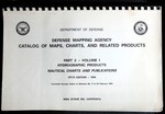
Seller Description: Good. Comb-bound Paperback. Good. General used condition. Evident wear. Text block clean and unmarked. See More Details
1994, Defense Mapping Agency/Department of Defense
Paperback, Good
Spring Branch, TX, USA
$19.43
-
4. Handbook of Magnetic Compass Adjustment Pub. No. 226
by Agency, Defense Mapping; Center, Hydrographic/Topographic; Spencer, Nye S.; Kucera, George F.
Seller Description: Hardcover 4th Edition (1980) in Very Good+ or Near Fine condition without a dust jacket. The covers are in great shape. Small abrasion to the front flyleaf. The interior pages are clean and unmarked. The book will be carefully packaged for shipment for protection from the elements. USPS electronic tracking number issued free of charge. 96 pages. See More Details
1980, Defense Mapping Agency
ISBN-13: 9781114810822
Hardcover, Very Good
BALTIMORE, MD, USA
$19.49
-
5. Pub No. 229 Vol 3: Sight Reduction Tables for Marine Navigation Latitudes 30-45 Inclusive
by Defense Mapping Agency
Seller Description: This is a used book in good condition and may show some signs of use or wear. This is a used book in good condition and may show some signs of use or wear. See More Details
1974, U. S. Government Printing Office
hardcover, Good
Tontitown, AR, USA
$20.41
-
6. Catalog of Nautical Charts: Miscellaneous and Special Purpose Navigational Charts, Sheets, and Tables
by Defense Mapping Agency Hydrographic Center
Seller Description: Very Good. Very Good condition. 4th edition. (Nautical charts, navigation, maps) See More Details
Wonder Book - Member ABAA/ILAB
Frederick, MD, USA
$20.84
-
7. Pub No. 229 Vol 3: Sight Reduction Tables for Marine Navigation Latitudes 30-45, Inclusive
by Defense Mapping Agency
Seller Description: Good. Hardcover. No DJ. Pages with only a couple underlines. Covers show light edge wear with rubbing. Binding is tight, hinges strong.; 100% Satisfaction Guaranteed! Ships same or next business day! See More Details
1970, U. S. Government Printing Office
Hardcover, Good
Wyoming, MI, USA
$21.94
-
8. Handbook of Magnetic Compass Adjustment Pub. No. 226
by Defense Mapping Agency; Hydrographic/Topographic Center
Seller Description: Good. Pages can have notes/highlighting. Spine may show signs of wear. ~ ThriftBooks: Read More, Spend Less. See More Details
Defense Mapping Agency HydrographicTopographic Center
Hardcover, Good
Reno, NV, USA
$21.98
-
9. Sailing Directions (Enroute): Pacific Islands. 5th Ed
by Defense Mapping Agency
Seller Description: Very Good. Large paperback in very good condition. 5th edition. See More Details
1996, Defense Mapping Agency
Softcover, Very Good
Vancouver, WA, USA
$26.10
-
10. Sight Reduction Tables for Air Navigation (Selected Stars) Epoch 1980.0
by U.S. Defense Mapping Agency, Hydrographic Center
Seller Description: Good. 29 cm, 324, v.1 only of the 3-vol. set, spiralbound, tables, Table 5--Refraction laid in (4 pages) DMA Stock No. NVPUB248V1. Volume I contains tables for selected stars for all latitudes, calculated for the epoch of 1980.0 and is intended for use for about 5 years. Pub. No. 249 has been designed for use with the Air Almanac. This is an important reference work, well organized for manual review. See More Details
1977, GPO
Silver Spring, MD, USA
$30.00
-
11. The Gulf Stream & Plot Chart of the North Atlantic Ocean
by Defense Mapping Agency
Seller Description: GOOD. 42X30. Worn White Paper Back Pages. Pages have highlighter marks, foxing, and slight aged toning. Text is clear. Contains both Black and White and Colored Illustrations. One side is about the Gulf Stream with the other is a Plot Chart of the North Atlantic. Overall in good condition. _PAB_ See More Details
1976, DEFENSE MAPPING AGENCY
PAPER BACK, Good
Princeton Antiques Bookservice
Atlantic City, NJ, USA
$30.00
-
12. A New Concept for Notice to Marines & Map Tracking Storms August 1975
by Defense Mapping Agency
Seller Description: GOOD. 42X30. 42X30 INCHES White Paper Back Pages. Pages have Highlighter marks and slight tanning marks. Text is clear. 1 side about the New Concept for Marines while the other is a Map Tracking the Storms during August 1975. Contains Colored and Black and White Illustrations. Overall in good condition. _PAB_ See More Details
1975, DEFENSE MAPPING AGENCY
PAPER BACK WHITE, Good
Princeton Antiques Bookservice
Atlantic City, NJ, USA
$30.00
-
13. Gazetteer of Undersea Features
by Defense Mapping Agency
Seller Description: Very Good++ Defense Mapping Agency. 1990 Stated Fourth Edition. Large softcover book. Pages all clean tight and bright, cover has a couple of very small marks otherwise clean and strong. See More Details
1990, Defense Mapping Agency
Softcover, Very Good
Rockville, MD, USA
$34.00
-
14. Area Planning: Europe-Africa-Middle East
by Defense Mapping Agency Aerospace Center
Seller Description: Good. Approx. 200, wraps, 4-hole punched, illus., maps, map on rear cover, covers somewhat worn and soiled. This is a DOD Flight Information Publication, AP/2. This appears to be a quarterly publication, with the next update scheduled to be issued on 22 January 1981. This is an important reference document for understanding aviation rules during a pivotal period in the Middle East. See More Details
1980, Defense Mapping Agency
Paperback, Good
Silver Spring, MD, USA
$35.00
-
15. French Guiana Official Standard Names Gazetteer
by (French Guiana) Defense Mapping Agency
Seller Description: Washington 1974 Defense Mapping Agency. Oblong 4to., 62pp., original decorated wraps. Light non-circulating library marks, no spine numbers, no pocket, no bookplate. VG. See More Details
Paperback, Very Good
Glen Head, NY, USA
$45.00
-
16. Sailing Directions (Planning Guide) for the North Atlantic Ocean
by United States. Defense Mapping Agency. Hydrographic/Topographic Center
Seller Description: Very good. No dust jacket. Cover. Shipping list no. : 88-164-P. Includes index. Item 378-E. See More Details
1988, Defense Mapping Agency, Hydrographic/Topographic Center: For sale by..
Trade paperback, Very Good
Chattanooga, TN, USA
$50.00
-
17. Collisions-1972 & Plot Chart of the North Atlantic Ocean
by Defense Mapping Agency
Seller Description: GOOD. 42X30. Worn White Paper Back Pages. Pages have highlighter marks, foxing, and slight aged toning. Text is clear. Contains Black and White and Colored Illustrations. One side about the Collisions in 1972 and the other is about Plot Chats of the North Atlantic Ocean. Overall in good condition. _PAB_ See More Details
1973, DEFENSE MAPPING AGENCY
PAPER BACK, Good
Princeton Antiques Bookservice
Atlantic City, NJ, USA
$50.00