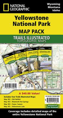
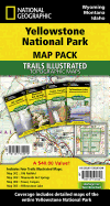
National Geographic's Trails Illustrated Maps are the most detailed and up-to-date topographic recreation maps available for US National Parks, National Forests and other popular outdoor recreation areas. A necessity for exploring the outdoors, each map is printed on waterproof, tear-resistant material. They also contain key safety and contact information, GPS and compass coordinates, Leave No Trace ethical guidelines and hundreds of points-of-interest, including scenic viewpoints, campgrounds, boat launches, swimming areas ...
Read More
National Geographic's Trails Illustrated Maps are the most detailed and up-to-date topographic recreation maps available for US National Parks, National Forests and other popular outdoor recreation areas. A necessity for exploring the outdoors, each map is printed on waterproof, tear-resistant material. They also contain key safety and contact information, GPS and compass coordinates, Leave No Trace ethical guidelines and hundreds of points-of-interest, including scenic viewpoints, campgrounds, boat launches, swimming areas, marine sanctuaries and wildlife refuges.
Read Less
Add this copy of Yellowstone National Park [Map Pack Bundle] (National to cart. $42.95, new condition, Sold by Russell Books rated 4.0 out of 5 stars, ships from Victoria, BC, CANADA, published 2010 by National Geographic Maps.
Add this copy of Yellowstone National Park, Map Pack Bundle to cart. $49.58, new condition, Sold by Paperbackshop rated 4.0 out of 5 stars, ships from Bensenville, IL, UNITED STATES, published 2012 by National Geographic Maps Division.
Add this copy of Yellowstone National Park [Map Pack Bundle] (National to cart. $88.32, new condition, Sold by Bonita rated 4.0 out of 5 stars, ships from Santa Clarita, CA, UNITED STATES, published 2023 by Natl Geographic Society Maps.

![Yellowstone National Park [Map Pack Bundle] (National Geographic Trails Illustrated Map)](https://www2.alibris-static.com/isbn/9781597754019_t.gif)
![National Geographic Road Atlas 2026: Scenic Drives Edition [United States, Canada, Mexico]](https://www2.alibris-static.com/national-geographic-road-atlas-2026-scenic-drives-edition-united-states-canada-mexico/isbn/9781566957069.gif)